Output 01
Online 3D environment
A browser environment where staff can view, visually inspect, measure and discuss the structure together.
- Browser
- Inspect
- Share
For municipalities and managers of civil structures
Photorealistic, measurable 3D scanning is now scalable and affordable. View bridges, viaducts and other civil structures remotely in your browser, without heavy software.
Everyday practice
Asset data, drawings, photos and inspection reports are often stored in different places. A detailed question about a bridge or viaduct can mean another site visit. An up-to-date, shared 3D environment makes remote visual assessment and discussion much easier.
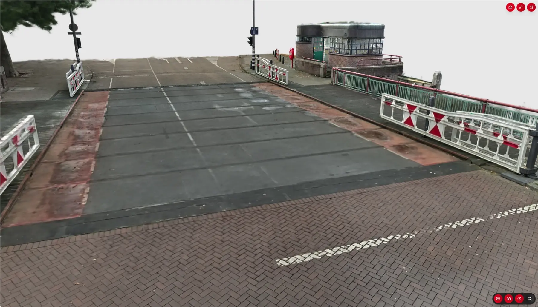
Capture the existing conditions before construction, renovation or maintenance begins. The 3D scan gives asset managers, designers and contractors a shared starting point. Everyone starts with the same view and can explore remotely, take measurements and prepare their work.
What you receive
The capture provides the foundation. For each structure, we agree the accuracy, level of detail and file formats to suit the asset management or project requirements.
Output 01
A browser environment where staff can view, visually inspect, measure and discuss the structure together.
Output 02
Geometric scan data for measurements, engineering and further technical processing.
Output 03
Drawings or a model of the existing situation, tailored to the structure and intended use.
Output 04
Documents, images and points of concern available at the right location on the structure.
In the office and on site
Everyone works from the same up-to-date view, with the context needed for their own tasks.
How it works
We choose the capture method and deliverables based on the structure, accessibility and your inspection or asset management needs.
Together, we determine which bridges, viaducts or other structures will provide value first.
We record the existing situation using mobile scanning technology suited to the structure and required accuracy.
We create the photorealistic 3D environment and link existing asset information where required.
Authorised staff and partners can view and discuss the structure directly in their browser.
These public authorities already work with 360Models

2026 introductory programme
For municipalities starting in 2026, we combine platform access and five inspection scans of civil structures in one straightforward introductory programme.
We agree in advance which structures to capture and what the capture at each location will cover.
Frequently asked questions
Practical answers about inspection, measurement and using the 3D environment.
The 3D environment enables remote visual assessment and discussion. It does not automatically replace a physical or legally required inspection; that depends on the inspection question and the required method.
Yes, the environment and point cloud support measurements. We agree the required accuracy and intended use in advance.
No. The 3D environment works in a current web browser, without installing heavy 3D or CAD software.
Yes. Relevant documents, photos and asset information can be linked to the structure or the right location in the environment.
Yes. Depending on the agreed scope, we can also deliver a point cloud, drawings or a BIM model.
In a short introductory call, we select a representative civil structure and discuss which inspection or asset management question the capture should support.
An introduction with no obligation
Tell us which structures or asset management questions matter to you. We will help you choose a suitable first capture.
Prefer to speak directly? Call +31 (0)10 307 6142.